Al centro della valletta di Laghel, solo dopo piogge abbondanti e ravvicinate si forma un piccolo lago che poi scompare in breve tempo. Le acque stagnanti sono assorbite da un inghiottitoio e vanno probabilmente ad alimentare una sorgente sottostante. Questa località, a detta di molti geologi è la dolina più grande di tutto l’arco alpino.

Laghel
11 Via del Calvario Arco
IT
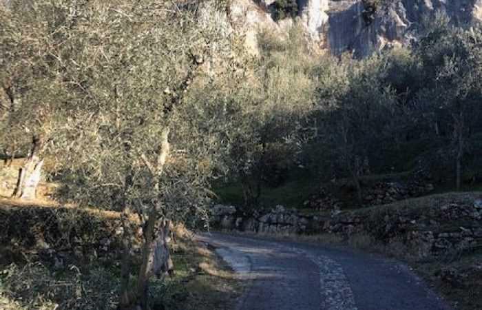
Laghel è una località che si trova ad ovest di Arco sotto il Monte Colodri. Si può raggiungere sia a piedi che in macchina. Per salire a piedi consigliamo di percorrere la caratteristica via Stranfora, proprio sotto la rupe del castello. Dopo l'antico lavatoio svoltando a sinistra, superata la porta murata ci si ritrova in via Fossa Grande. Si costeggia l’entrata del Parco Arciducale quindi si tiene la destra seguendo le indicazioni per il castello. Mentre si sale, sulla destra si vede la zona ad ovest del castello di Arco. Poco più in su si arriva all’incrocio tra l'olivaia e l'inizio della via Crucis. Quest'ultima ci condurrà salendo tra gli ulivi su fondo lastricato all'abitato di Laghel. Facciamo attenzione al traffico veicolare, che utilizza la Via Crucis per scendere da Laghel. Per raggiungere Laghel in macchina saliamo da Via Fossa Grande per poi condividere per alcuni metri il percorso con i pedoni e i ciclisti. All'incrocio Via Crucis-olivaia prendiamo a destra.
A Laghel si trova il santuario di Santa Maria di Laghel, anche noto come chiesa di Santa Maria Annunziata.
A lato del santuario parte il sentiero che porta alla croce dei Colodri.
Alcune notizie.
La dolina è una conca chiusa, tipica dei pianori costituiti da rocce calcaree, formatasi in seguito alla dissoluzione del carbonato di calcio costituente le rocce. E’ tipica di aree in cui si manifesta il carsismo superficiale.
EN
Laghel is a locality to the west of Arco under Monte Colodri. It can be reached on foot or by car. To go up on foot, we recommend taking the characteristic via Stranfora, just below the cliff of the castle. After the old washhouse, turning left, after the great gate, you find yourself in via Fossa Grande. Walk along the entrance to the Parco Arciducale then keep to the right following the signs for the castle. As you go up, on the right you can see the area to the west of the castle of Arco. A little further up you reach the crossroads between the olive grove and the beginning of the Via Crucis. The latter will lead us up among the olive trees on a paved ground to the village of Laghel. Pay attention to vehicular traffic, which uses the Via Crucis to descend from Laghel. To reach Laghel by car, go up Via Fossa Grande and then share the path for a few meters with pedestrians and cyclists. At the crossroads Via Crucis-olivaia turn right.
In Laghel there is the sanctuary of Santa Maria di Laghel, also known as the church of Santa Maria Annunziata.
Next to the sanctuary starts the path that leads to the Colodri cross.
In the center of the small Laghel valley, only after abundant and frequent rains a small lake forms just to vanish after a short period of time. The stagnant waters are absorbed by a sinkhole and probably feed an underlying spring. According to many geologists, this is the largest sinkhole in the entire Alpine arc.
The sinkhole is a closed basin, typical of plateaus made up of calcareous rocks, formed following the dissolution of the calcium carbonate constituting the rocks. It is typical of areas where surface karst occurs.
DE
Laghel ist eine Ortschaft, die westlich von Arco unterhalb des Monte Colodri liegt. Man kann ihn entweder zu Fuß oder mit dem Auto erreichen. Für den Aufstieg zu Fuß empfiehlt es sich, die charakteristische Via Stranfora unterhalb des Burgfelsens entlang zu gehen. Nach dem alten Waschhaus biegen Sie links ab, passieren das ummauerte Tor und befinden sich auf der Via Fossa Grande. Sie kommen am Eingang zum Arciducale-Park vorbei und halten sich dann rechts und folgen den Schildern zum Schloss. Wenn Sie aufsteigen, sehen Sie rechts das Gebiet westlich des Schlosses von Arco. Ein Stück weiter oben stoßen wir auf die Kreuzung zwischen dem Olivenhain und dem Beginn der Via Crucis. Letztere führt uns zwischen Olivenbäumen auf einer asphaltierten Straße hinauf zum Dorf Laghel. Achten Sie auf den Autoverkehr, der die Via Crucis für den Abstieg von Laghel nutzt. Um Laghel mit dem Auto zu erreichen, steigen wir die Via Fossa Grande hinauf und teilen uns dann für einige Meter den Weg mit Fußgängern und Radfahrern. An der Kreuzung Via Crucis-Olivenhain biegen wir rechts ab.
In Laghel befindet sich die Wallfahrtskirche Santa Maria di Laghel, die auch als Kirche Santa Maria Annunziata bekannt ist.
An der Seite der Wallfahrtskirche beginnt der Weg, der zum Colodri-Kreuz führt.
Einige Neuigkeiten.
In der Mitte des Laghels bildet sich ein kleiner See, der nur nach heftigen und kurzen Regenfällen entsteht und nach kurzer Zeit wieder verschwindet. Das stagnierende Wasser wird von einer Senkgrube aufgenommen und speist wahrscheinlich eine darunter liegende Quelle. Dieser Ort wird von vielen Geologen als die größte Doline im gesamten Alpenraum bezeichnet.
Die Doline ist ein geschlossenes Becken, das typisch für Hochebenen aus Kalkstein ist und durch die Auflösung des Kalziumkarbonats, aus dem das Gestein besteht, entstanden ist. Sie ist typisch für Gebiete, in denen Oberflächenverkarstung auftritt.
